The Quaternary Geological Park project, in the province of Granada, is an initiative to protect the most complete continental geological record of the Quaternary era on the planet
By Nick Nutter | Updated 18 Mar 2023 | Granada | Places To Go |
Login to add to YOUR Favourites ![]() or Read Later
or Read Later

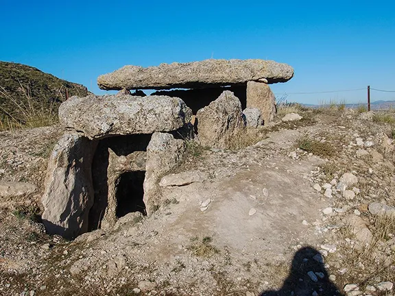
Megalithic Dolmen Gorafe
There are not many places in the world where you can experience 65 million years of history in a visit. There is one area, in Andalucia, where you can rub shoulders with geologists, historians, archaeologists, anthropologists and people just interested in the heritage of Andalucia, one area that shows you the tectonic processes that created this land, one area that has evidence of the first humans to settle in Europe 1.4 million years ago (mya), one area with ancient monuments dating back to the earliest farmers and that one that has a continuous record of occupation to the present day. That area is the Granada Geopark.
The Quaternary Geological Park project, in the northern valleys of the province of Granada, is an initiative to protect the most complete continental geological record of the Quaternary era on the planet. Due to its exceptional geological, landscape and cultural richness, 47 municipalities in the Hoya de Guadix and Baza (Guadix - Baza Depression) are represented in the Granada Geopark.

Castellon Alto
The depression began to form during the tectonic processes that caused the alpine system uplift about 65 mya and there is a continuous record of the erosion, sedimentary processes and tectonic movements that have shaped the landscape ever since, not to mention the plants, animals and people that, during the same period, have called it home.
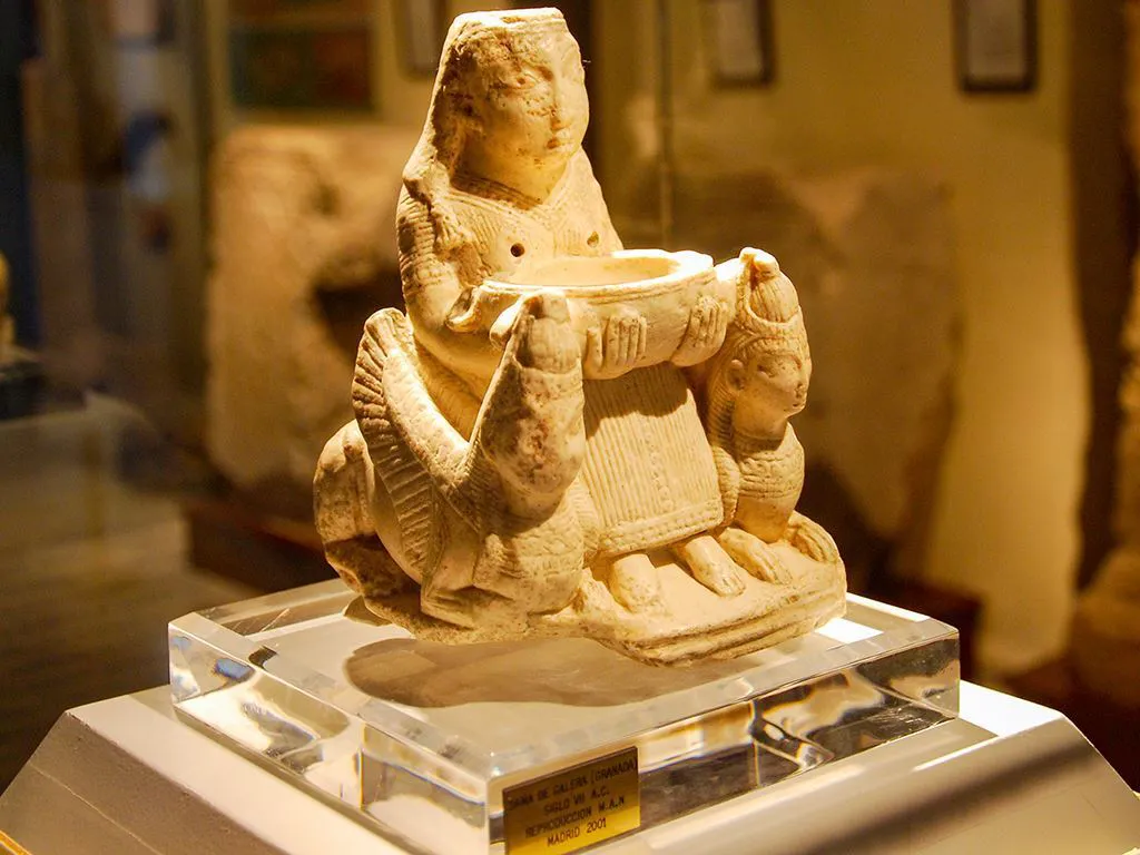

Dama de Baza
Ongoing excavations at Fonelas are revealing intriguing secrets of the Quaternary period, 2.8 mya – 0.012 mya, and raising questions, particularly concerning the existence of a land bridge between the Iberian peninsula and Morocco. Horizontally arranged oceanic sediments characterise the geology of the area and the visitors site at Fonelas has one of the best quaternary records of Europe. Five million years ago a large lake, the paleo-lake Baza, existed to the east of Fonelas. The lake drained about 500,000 years ago after earthquakes allowed the paleo-river Fardes, that flowed out of the lake in a westwards direction, to be captured by a tributary of the Rio Guadalquivir.
During the period that the lake existed, the area had a diverse and rich flora that attracted herbivores, predators, scavengers, and, if the human remains, a molar from Orce, are correctly dated, an early species of humans, from about 1.4 million years ago. Visitors to the centre can see the fossilised bones from animals that were native to Africa, such as the Brown Hyena and a wild pig now native to sub Saharan Africa, goats plus wolves, coyotes and jackals. Those species were, apparently co-existing with other large mammals from Asia, all now extinct, such as the Etruscan wolf, Leptobos etruscus (a large bovine), a new species of Praeovibos (a giant muskox), and Mitilanotherium (an early giraffe).
The early human story is well presented at the Museum of Prehistory in Orce.
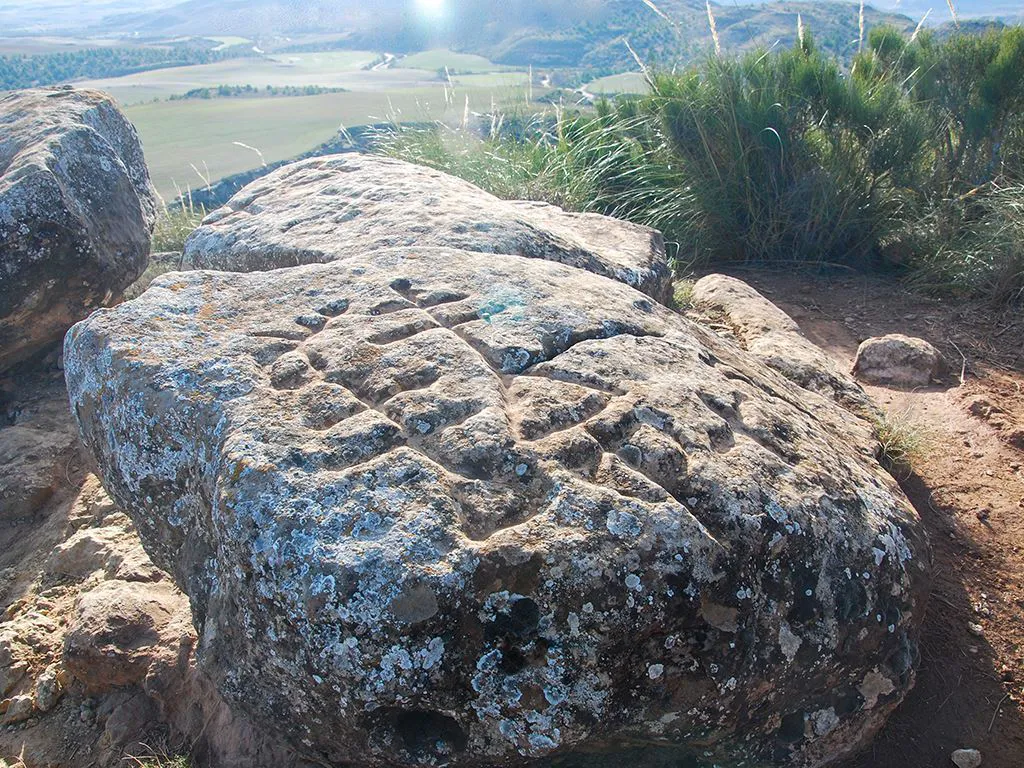

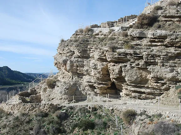
Petroglyphs Cerro de la Minas
An astounding, and unique in Europe, example of a geolithic process can be discovered at the Toril aqueduct, south of Villanueva de las Torres. The kilometre long travertine aqueduct is a natural formation, up to 15 metres high and 4 metres thick, formed by the precipitation of calcium carbonate from a hot spring over a period of 216,000 years. The hot spring still flows down its channel on the top of the aqueduct, ever increasing the aqueduct’s height and width. The walls of the aqueduct host a variety of plants, including one unique to the aqueduct, Limonium Alicunense (Plumbaginaceae), that enjoy a mineral-rich environment and, in places, a dash of warm water spray from the occasional leak in the channel.
Video By: Julie Evans

Petroglyphs Cerro de la Minas
The first evidence of human activity visible on the surface of the landscape is the largest concentration of dolmens, or megalithic tombs, in Europe. There are over 240 of these tombs, some constructed from stones that a grown man could lift and others from slabs that could only have been moved by an entire tribe. Take a walk in the Badlands of Gorafe and you will see dozens of these structures, many constructed before the Egyptians built their pyramids. In 2011, the Megalithic Interpretation Centre at Gorafe village opened its doors to illustrate the history of the dolmens and to house a small orthostat, a vertical stone found in a dolmen, used as support for the capstones, with an engraving that continues to excite archaeologists.

Travertine Aqueduct
The same people found time, between building dolmens, to mark their territory with a petroglyph. On a high ridge, overlooking the Gor river valley, the megalithic builders found a source of ‘almagra’, a soft, deep red ochre, that, mixed with grease, makes a paint. Near to the source of almagra, they also found five sandstone blocks suitable for engraving. The petroglyphs depict male and female figures dancing, the sun and moon and other symbols that could represent bows and axes. The sun symbol is deeply incised in a bowl and still used today for ritual offerings. The petroglyphs of the Cerro de la Minas are difficult to locate, not signposted, not waymarked and unmarked on arrival.
The megalithic period merged with the Copper Age and, on a small hill in the valley of the River Gor, not 300 metres from the modern A92 viaduct, is Las Angosturas de Gor, possibly the most important archaeological site in the Gor valley and one of the least publicised. Results from a series of digs in the 1980s indicated that Las Angosturas was occupied from the Neolithic period, about 3000 BC right through to the Ibero-Roman period about 200 BC.
Moving on in time to around 2200 BC, we come to the Argaric period, probably the first society in Andalucia. These bronze age people built settlements on hills and buried their dead behind the walls of their houses. On a craggy spur on the banks of the river Castillejar, near the modern town of Galera, is an Argaric settlement site called Castellón Alto. The site covers about half a hectare and overlooks a fertile plain known as the Baza – Huescar plateau. Galera has one of the most impressive museums covering this period in Granada province.
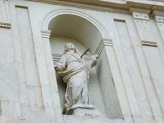
The Iberians appeared during the 7th century BC and left a huge necropolis at Tutugi, near Galera and a fortified town, or oppidum, at Basti, on the outskirts of Baza. It is here that the Dama de Baza was discovered in 1971.
Meanwhile, work continues in the Granada Geopark. Barely a year passes without another discovery that helps us to understand our past.
The Granada Geopark is a place to explore. Whilst there are a plethora of interpretation centres and museums illustrating all aspects of the Geopark there is no more exciting a way of delving into the area than on foot. You will often find yourself off the beaten track, discovering the hidden secrets of this incredible landscape. It is a venue for scientists and researchers from all over the world. We are lucky to live on its doorstep.
© Visit-Andalucia 2015 - 2024
 Huéscar