Galera is a village in the Granada Geopark on the Altiplano of Granada, Andalucia, location of Castellon Alto, an Argar culture settlement and Turtugi, an Ibero-Roman necropolis
By Nick Nutter | Updated 18 Mar 2023 | Granada | Villages |
Login to add to YOUR Favourites ![]() or Read Later
or Read Later
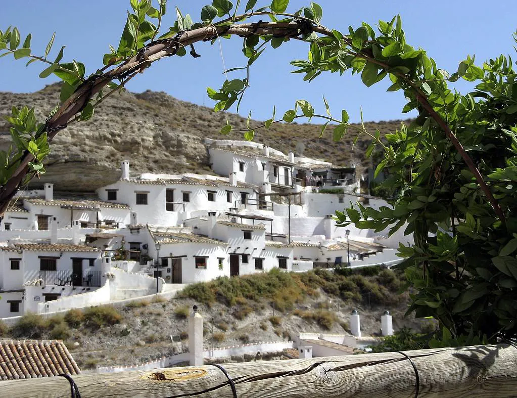

Cave houses at Galera
In the far north-eastern reaches of Granada province, Galera is a small town on the high, dry, flat plains of the Altiplano Granada. If known at all, it was due to the presence of the cave dwellings most of which were carved from the rock by immigrants during the 19th century, although some date back to the mediaeval period. That is until recently. Most towns would be happy to have one notable historical feature to attract visitors. Galera has two.
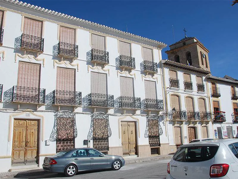

Mudejar balconies at Galera
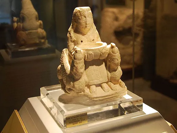
The first to be discovered, in 1914, was the Iberian necropolis of Tutugi. Over the last hundred years, the story of how the necropolis was discovered has evolved into a myth. A young girl, Maria, supposedly had a dream that great treasures would be found in the place she designated. The townspeople of Galera started to dig and found numerous tombs on a hill just outside the village. In one tomb they found a 7th century BC alabaster figurine that originated in Syria, now dubbed ‘The Dama de Galera’. Tutugi, by the way, was the Ibero-Roman name for the town now called Galera.
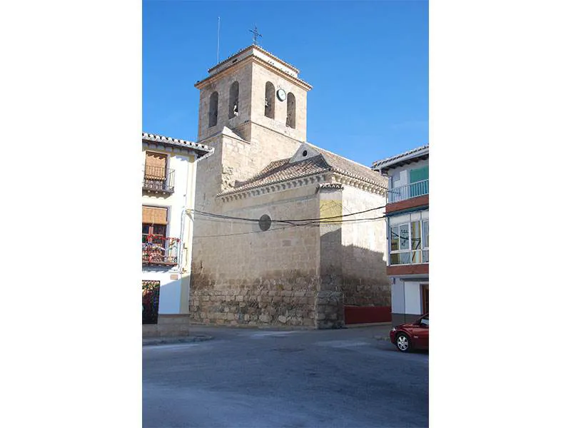

Mudejar church at Galera
The second site is called Castellón Alto. This is a fortified settlement built by people of the Argar culture and was occupied between 1900 BC and 1600 BC. The site was excavated during the 1980s and opened to the public in 2005. It is now considered to be one of the most important sites representing the Argar period in Andalucia. During the excavations, in a cyst behind one of the dwellings, a grave was found. It contained the mummified body of two individuals, a man in his late 20s and a young child, together with grave goods consisting of ceramic vessels, copper bracelets, silver rings, a copper dagger and a copper axe. It has been established that the pair were father and son, although the son died sometime before the father.

Morisco Revolt 1568
The Iberian period follows the Argar. This is the time when the necropolis at Turtugi was being used. Tutugi prospered during the Roman period. In fact, it was a favourite place for Roman landowners. In the valley of the Rio Galera alone, there were over 35 Roman villas. Many were self-contained farming estates run by slaves and overseen by foremen on behalf of absentee Roman landlords.
When the Romans left Andalucia, the population started to decline during the Visigothic period and under the Moors.
Galera was occupied by the Moors until 1230 when Rodrigo Jiménez de Rada, archbishop of Toledo, conquered the town. It was held by Christians until 1319 when it was recovered by Ismail I, the Nasrid ruler of the emirate of Granada. It was finally restored to the Christians in 1488.
Video By: Julie Evans
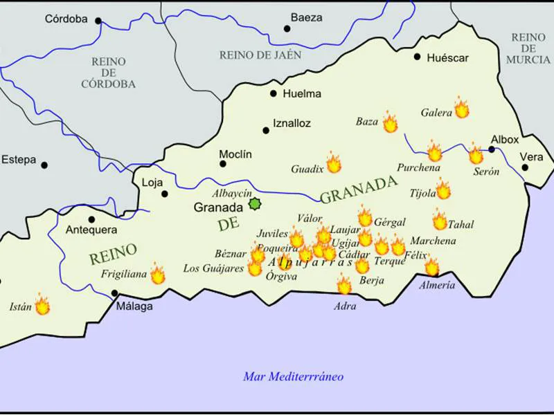
In 1568, the Moriscos in Galera, along with other Moriscos throughout Granada, rebelled against the crown in what has become known as the Morisco Revolt, or War of the Alpujarras or Rebellion of the Alpujarras. Whilst neighbouring towns capitulated to the Christian forces, Galera held out. The monarch, Philip II, ordered his half-brother, Don John of Austria to retake the town. Don John salted the fields surrounding the town, making it impossible to grow crops. He then went from house to house and slaughtered all the 2500 inhabitants.
Galera was repopulated later during the 16th century by families from Valencia, Murcia and La Mancha. Once again the population started to expand and reached its maximum during the 1950s, about 5,000 inhabitants. Most people worked in agriculture, including growing hemp that was used in the town to make hemp rope for the Spanish Navy. The decline of the rope making industry and rural industries has caused the younger elements of the town to find work in the cities and on the Costas.
Within the town, not much is preserved of its, often violent, past. Three watchtowers date back to the Moorish period. Only two can be recognised as such, Fuente Amarga and the Ozmin tower.
For such a small town, barely 1,000 inhabitants, Galera has one of the most impressive museums in Granada province. Not necessarily for its size or number of exhibits, rather the quality of what is displayed, and the information provided, not least by the knowledgeable curator.
The museum is housed in what was a chapel of a convent and occupies three floors. The history of the area from pre-Neolithic times, through the Copper and Bronze Ages, and the period of the Argar culture is well covered. Many of the exhibits displayed were voluntarily donated by the population of the town who had been finding artefacts for generations. One triumph for the museum is the retention of the original mummy and funerary items from Castellón Alto, preserved in a specially constructed, airtight, cabinet. Unfortunately, the town was unable to keep hold of the original ‘Dama de Galera’ which was sold soon after it was found for the princely sum of 179 pesetas (about 1 year's pay for a farm labourer in 1914) and is now in the National Archaeological Museum in Madrid, a copy is in the museum in Galera.
The Iglesia de la Anunciación was built in the early 16th century in a style called ‘Granada Mudejar’. In 1983 it was given the status of a National Monument due to its beautiful wooden ceiling and the 17th century baroque style plaster decorations in the chapel.
Whilst in Galera, hunt out a dish called ‘segurena’, lamb from Segura. The lambs are reared in the vicinity and are protected by the IGP seal (an EU guarantee of quality). They are known for their exquisite flavour. You will normally find the lamb roasted on a bed of potatoes, a traditional Andalucian feast.
A geoparque (geopark or geoparc) is a well-defined territory, home to a valuable natural geological heritage. The most important parts of a geoparque, due to their scientific, aesthetic, or educational value, are called geosites.
In the north of Granada, surrounded by some of the tallest mountains of the Iberian peninsula, what we know today as the Basin of Guadix or the Guadix - Baza depression or basin was, for 5 million years, a lake with no outlet to the sea. Sediments, brought down by the mountain streams, were deposited in the basin in horizontal sheets. 500,000 years ago the basin drained to the west and new streams carved out the canyons, ravines and badlands that characterise the area, the most southerly desert in Europe, today.
Galera is a geosite due to the Argar fortified settlement, Castellon Alto, the Iberian Necropolis, Turtugi and the many unexcavated archaeological sites in the locality.
© Visit-Andalucia 2015 - 2024
 Tútugi Iberian necropolis
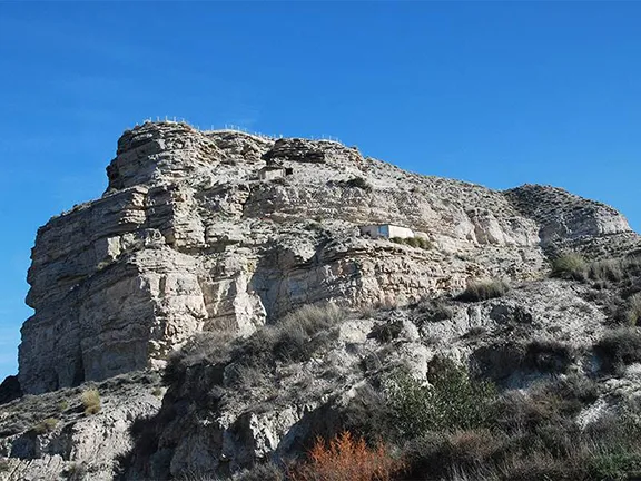 Castellón Alto