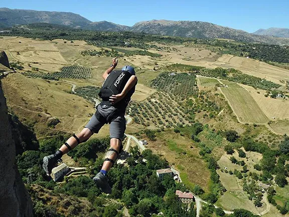
BASE stands for building, antenna, span and earth (cliff), the four fixed objects devotees of this extreme sport use to gain height before launching themselves into thin air
By Nick Nutter | Updated 5 Mar 2022 | Andalucia | Extreme Sports |
Login to add to YOUR Favourites ![]() or Read Later
or Read Later

Exit at Ronda. Image courtesy of andalucia informacion
Do you get a rush from climbing a high peak and standing on a ledge hundreds of metres above the valley below? Then imagine the adrenaline buzz you would get if you then flung yourself off that ledge with nothing more than a parachute on your back to guarantee a safe landing.

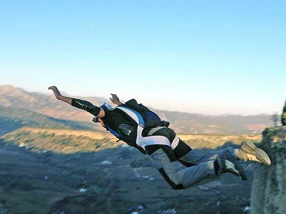
Archidona exit. Image courtesy of Eder Navacerrada
The sport is called BASE jumping. BASE stands for building, antenna, span and earth (cliff), the four fixed objects devotees of this extreme sport use to gain height before launching themselves into thin air. The sport started in the early 1980’s when the equipment needed was the same as that required for skydiving, a parachute and a reserve. Since then specialised equipment has been developed including wingsuits that allow the diver to move 8 metres horizontally for every 1 metre they fall. BASE jumpers these days do not normally have a reserve chute.
With its mountainous terrain it is not surprising that Andalucia has several recognised ‘exits’, i.e. places from which to jump, 21 to be exact.

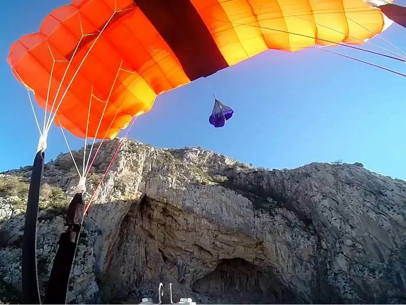
Ronda exit. Image courtesy of Diario Ronda
Salto del Cabrero
First jumped in 2016 by Éder Navacerrada with the help of Miguel, Ana and Tere
Access
Park in the town of Benaocaz in the Sierra de Grazalema.
Approach
Take a goat trail from the town of Benaocaz. 1h traverse on a gentle slope with some wide-open areas. When you get to the last section, instead of following the signs to the left, continue straight leaving the highest peak to your left. Ascend the field with a 40-50m incline, until you get to the top, always leaving the highest peak to your left. You will arrive at the exit 85 metres above the landing area which is in the middle of a rocky valley. It is a small patch of grass about 10 metres in diameter surrounded by goat trails, rocks and oak trees on a gentle slope. A large fallen oak marks the spot. It is highly recommended that you walk the landing site before jumping, because it’s technical and there is little margin for error.
Bermejo
First jumped in 2015 by Juan Arenas and Jonathan Trango.
Access
From Rute in the Sierra Subbeticas, continue along the A3226, about 20kms, until you see a cliff to your right. There is a narrow road that continues for several kilometres to a parking area.
Approach
Hike towards the mountain and ascend up a ditch that is very visible towards the right. The exit is 130 metres above the landing area. There are several ledges at the exit and the cliff face is semi-circular. Best to have a good push to clear the ledges.
Via Orion
First jumped in April 2015 by Éder Navacerrada
Access
From the Motril road.
Approach
It is about 15 minutes on foot from the car park, following a maintenance road that leads to the radio masts. The exit is just before the masts, 170 metres above the landing area. You need to push hard on the exit to clear a little outcropping near the top, the rest is overhung or vertical. Minimum 2 second delay. Landing is easy.
Relacion con el Aire
First exit in February 2016 by Jonathan Trango. Beautiful jump located in front of the cliff of Escalante and behind Orion.
Access
From the Motril road.From the coastal road of Málaga – Motril, take route N-323 towards Granada. The road takes you through the Los Vados canyon, where you will see the cliff on the left beyond the first hard curve to the right. After crossing the river the landing area will be visible below the cliff.
Approach
You can reach the top by car (about 30 min on a small road), and then a short downhill path is a 15 min walk on an unused trail. The exit is 130 metres above the landing area which is a beautiful clearing amongst avocado trees.
Spanish Yoga
Exit opened in August 2015 by Anaconda, Cristian Andersen, Eder Navacerrada and Jonathan Trango. Exit located on the Escalante cliff. At the moment it is the highest cliff in Andalucía, and the location of the first and only wingsuit (Eder Navacerrada) jump and tracking (Cristian Andersen) jump.
Access
From the coastal road of Málaga – Motril, take route N323 towards Granada. The road takes you through the Los Vados canyon, where you will see the cliff on the left beyond the first hard curve to the right. Park below the cliff.
Approach
Take the path that heads up to the left of the cliff, pass by a house with lots of dogs. Continue straight ahead when the path ends. You will find many possible exits, but the best one is a comfortable rock ramp before the peak. The landing area is 230 metres below, next to the river.
Pena de los Enamorados
Exit opened by Éder Navacerrada and Tony Mad in February 2013
Access
The mountain forms the profile of a face. Take route A-354 from Antequera towards Archidona. The road is parallel to the railroad track and passes by the jumpable cliff. The cliff faces northeast (the chin) and the trailhead is at the foot of the southeast face (the forehead).
Approach
Parking is on the roadside at the widest point next to the river valley. Use as a reference an abandoned mine next to a vertical limestone cliff that is on the other side of the railroad track. Cross the river. There is no bridge, but you can usually cross over on a fallen tree. Then cross the train track (be careful, there is a blind curve) and hop a livestock fence (there are feral goats all over). The area may be private or part of a park because of the fence. All of the approach is uphill. A 10 metre abseiling rope is useful at the exit. It is approximately 115metres to impact and 200metres to the landing zone which is an open field a little to the left of the exit.
Chilam Balam
Exit opened in May 2015 by Eder Navacerrada and Jonathan Trango.
Access
Villanueva del Rosario.
Approach
Parking near the olive trees. Walk up along the Cliff to the left. (25min). The exit ledge is rocky and uneven. There is a big overhang and steep talus. It is 75 metres to impact. Thorny plants surround the landing area.
Desplomilandia
Exit opened in May 2015 by Eder Navacerrada and Jonathan Trango.
Access
Guadalhorce dams.
Approach
Park at the para-glider launch site. Walk up between the two cliffs. (30min). It is 135 metres to impact with 150 metres of talus. Take a short delay to make it to the main landing area. A longer delay will leave you aiming for a narrow path.
El Torcal
Exit opened in February 2015 by Eder Navacerrada and Jonathan Trango.
Access
Villanueva de la Concepción.
Approach
Look for a turn left on the cliff, reach the gully, and from there a labyrinth of rock formations will take you to the exit. (40min). It is 140 metres to impact with 50 metres of talus.
La Vida es Ahora
Exit opened in May 2015 by Eder Navacerrada and Jonathan Trango.
Access
The town of Alfarnatejo
Approach
Nice parking among the olive trees. Walk the path that goes around the mountain on the right (East). Cross a small creek surrounded by thorny bushes. (45min). It is 140 metres to impact with 50 metres of talus. It is an easy exit but you must clear several positive outcroppings at 10m and 40m. Recommend a hard push and minimum 2 second delay.
Verticalandia
Exit opened in June 2015 by Jonathan Trango
Access
Guadalhorce dams
Approach
Park at the para-glider launch. Hike up in between the two cliffs (30min). It is 110 metres to impact. With 150 metres of talus. A hard push off is recommended. Land on the track.
Caminito del Rey
Exit opened in July 2015 by Jonathan Trango
Access
The town of El Chorro
Approach
Use the El Mirador restaurant parking lot. Hike towards the Caminito Del Rey track, then take the right fork that takes you up to the exit. (40min). It is 120 metres to impact with an outcropping at 60 metres and 100 metres of talus.
To get out, take Caminito del Rey track to the second canyon, and before the guard shack, go up towards the left to return to the path. Smile to the cameras.
There are other exits nearby, but with less altitude to impact. Tight landing. Wind currents are common thru the canyons. Verify good landing conditions below.
Tajo de la Madera
Exit opened in May 2015 by Eder Navacerrada and Jonathan Trango
Access
Villanueva del Rosario.
Approach
Park near the local farmhouse. Hike up along the cliff to the left. (45min). It is 85 metres to impact with 50 metres of talus. There si a shelf at 25 metres. Hard push off recommended. Land between the olive trees.
Alfarnate
Exit opened in July 2016 by Jonathan Trango in a cliff atop the town of Alfarnate.
Access
From Alfarnate take route MA-156, and turn left into the single lane, that later reaches the cliff that is northeast of town. Park beneath the cliff.
Approach
Hike up until you are more or less below the exit. From there take a path that traverses the cliff to the left. There is some scrambling required but no climbing gear necessary. Once on top, follow the crest to the right and you will find the exit point. It is 90 metres to impact with a good landing on the road or in the fields below. The upper part of the cliff is overhung, but about 50m down there are some positive shelves. Keep that in mind. There are also some positive ridges to the left that are close. 90 degrees off heading to the left is not recommended.
Archidona
Exit opened in November 2015 by Eder Navacerrada, Jonathan Trango and Saulo Fortuna. Jump located in the large cave of Archidona, famous rock-climbing school.
Access
From the A-92 (Sevilla-Granada) highway, take the exit to route A-7201. Take this route to the town and at about 100m take the left fork in the road. Then take a sharp turn to the left and park under the cave.
Approach
Hike up and around the left side of the mountain. You will have to walk along a sharp edge and then climb down to the top of a large overhang. Taka a static line and some form of anchor. It is 60 metres to impact to a tight landing and in the largest opening in the olive grove, with caution and little altitude to play around. This jump is adequate for static line, but there are no anchors at the exit. We have used ropes tied to bushes and later retrieved them.
El Bunker
Exit opened in July 2016 by Jonathan Trango located on the cliff near the port of los Alazores. Between Alfarnate and Villanueva del Trabuco. At the base of the cliff are the ruins of a Spanish civil war bunker, hence the name.
Access
From the Venta Puerto de los Alazores, the cliff is visible to the south. Park on the road below the cliff.
Approach
Ascend walking around the cliff to the right. You do not ascend to the peak. The exit point is on top of a red vertical pillar. The cliff is completely vertical with some positive outcroppings. It has been rappelled 10 meters to get to the most positive part of the cliff. You can exit from much higher but be aware that you will be opening close to the cliff. It is 95 metres to impact. Landing is in a rocky field below or the road. Watch out for traffic.
Peoema Roca
Exit opened in July 2015 by Jonathan Trango. Beautiful and emblematic jump, because you fly along the largest and most famous cliff Chorro. Quite visible from the town below.
Access
Park the car below the “Escalera Árabe” climbing area.
Approach
From there you ascend the steps and continue until you are almost at the peak of the “Frontales” face. Then you need to make two 165ft (50m) rappels to access a large shelf atop large overhangs. Take 2 x 200ft (60m) ropes, and rappelling gear. There is some planning necessary to retrieve the rappelling gear. Therefore you must throw the ropes down or have someone to carry them down or jump with them. You can also climb down a steep grade without rope, in which case you don’t need rope or any other gear. It is 140 metres to impact to a hairpin curve in a pine forest. Make sure the conditions are right.
Tajo del Medio Dia
Exit opened in May 2016 by Jonathan Trango. A nice wide cliff located above a beautiful forest. It can be seen clearly from the Málaga – Granada highway.
Access
From Villanueva del Trabuco, take route MA-4100, and quickly turn right on a ramp towards the mountain to the southeast, that ends in Alfarnate. After a few kilometers you will see a forest below the talus, then turn left to park in the landing area.
Approach
Walk up the 400 metre slope up the cliffto the right, until you reach the exit point. It is 70 metres to impact in a clearing in an olive grove.
Low jump and positive cliff. There are two possible exit points. One is 60 metres with a little more overhang and the other is 70 metres with a little bit of positive cliff. Be careful, there is little margin for error on this jump.
Veleta
Exits opened to the north of Veleta. The first exit was opened by Àlex Txicon, Patrick Guisasola and Dario Barrio. The second exit (High Veleta) was opened by Jonathan Trango in April 2016
Access
Winter access: 2 hour hike in snow and ice. 800 metre slope, cold, altitude, etc. Anchor in the snow or rock to rappel. Jump with crampons. Great landing in the snow. Summer access: easy, but landing is tight with lots of large boulders and rocks. You will need a 15 metre abseiling rope. The height is 130 metres.
© Visit-Andalucia 2015 - 2024
 Kitesurfing
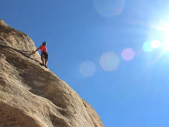 Climbing
 Jet Skiing