The Sierras de Cazorla, Segura y Las Villas Natural Park is the source of the Rio Guadalquivir
By Nick Nutter | Updated 25 Jun 2022 | Jaén | Places To Go |
Login to add to YOUR Favourites ![]() or Read Later
or Read Later
The source of the Rio Guadalquivir
Since time immemorial the Rio Guadalquivir has been the lifeblood of Andalucia. Its waters irrigate the wide plains from Jaen, through Cordoba to Seville and out to the Atlantic Ocean at Sanlucar de Barrameda. With a length of 657 kilometres it is the fifth largest river in the Iberian peninsula and drains an area of 58,000 square kilometres. Known by the Romans as the River Baetis, at that time it was navigable as far as Cordoba, a distance of about 260 kilometres. Today large ships can only reach Seville, about 123 kilometres from the sea. Its modern name originates from the Arabic name for the river which was al-wadi al-kabir, that literally means great valley. So fertile and productive is the valley that, during Moorish times, the population farming the land was reckoned to be greater than that of today.

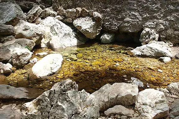
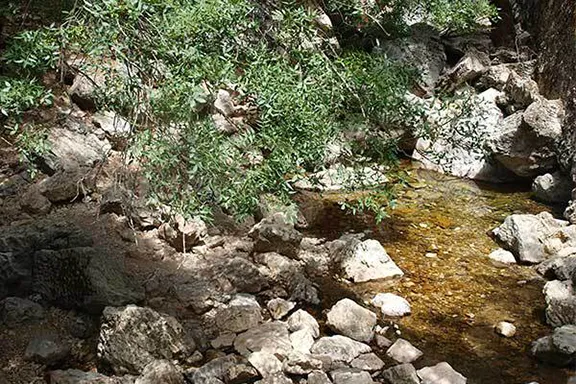
Looking downstream from the source
Even prior to Roman times the Rio Guadalquivir was a magnet. The wooded valleys and plains were populated by a number of species of herbivores that attracted hunters, including humans. In Neolithic times the human population of the valley increased exponentially and settlements began to appear. Tribes started to coalesce and assume identities to differentiate themselves from one another or were given identifying names by the peoples that started to trade with them. In the upper Guadalqivir the people were known by Roman times as Iberians and they were divided into tribes, Oretani and Bastetani. Further towards the Atlantic the people were known as Turdetani and they were also split into tribes, Cilbiceni, Elbisini, Etmanei, Ileates and Tartessii. To the north of all these tribes, occupying the centre of the Iberian peninsula was a people known as Celt Iberians. Even today there is confusion as to which tribe occupied which area, where they originated, what language they spoke, how the tribal name should be spelt and the interactions between them. During the Roman period the confusion was even greater.
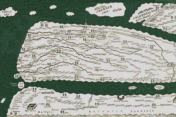
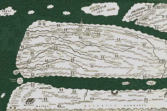
The Tabula Peutingeriana
Knowing who you were going to fight and where you were going to fight them was important information for the Romans. In their time there were no maps as we would recognise them, rather they had portolans which used geographical data, like the source of a river, the location of a prominent ridge or summit and physical data such as how far a legion could march in a day, the names of settlements and so on to describe a route from A to B. This information, first recorded in tabular form, was eventually transcribed into a pictorial form. The Tabula Peutingeriana is an example of a 5th Century Roman Road Map. Spain is to the left of the map and you can see the Rio Guadalquivir more or less accurately positioned, but, 400 years earlier it was down to Gaius Plinius Secundus (23AD – 79), better known as Pliny the Elder, an author, naturalist, natural philosopher, historian, geographer and an all round good guy to once and for all fix the position of the source of this river.
Pliny wrote in his Natural History (3.1 s.3), “The Baetis does not rise near the town of Mentesa in the province of Tarraco, as some have said, but in the mountain range of Tugia, close to where the river Tader waters the territory of Carthage. It swerves around the funerary monument of Scipio and, resuming its way towards the west and, adopting the province like its own daughter, heads for the Atlantic Ocean, small in the beginning, but receiving many tributaries on its way which it deprives of their fame as well as their water”.
Was he correct? There was only one way to find out so on Friday 12th June 2015, Julie and I set off to reach the source of the Rio Guadalquivir.

The Roman town of Mentesa Bastia is now known as La Guardia de Jaen, 5 kilometres south east of Jaen city. Tugia is now known as Peal del Becerro about 50 kilometres north east of Jaen city in the foothills of the Sierras de Cazorla. The River Tader, now called the Segura, flowed east into the sea at Cartagenia. Publius Cornelius Scipio (the father of Scipio Africanus the Elder) died in 211 BC at a location on the Upper Baetis River following the Battle of the Upper Baetis against Carthaginian forces led by Hadsdrubal Barca. The battle was fought in two actions, the first near the present town of Castulo just south of Linares, in this action Publius was left dead. The second part of the action took place a few days later at a place called Ilorca, possible Lorqui, just north of Mercia on the river Segura, in any case well away from the Baetis river. At this action Gnaeus Scipio was killed. The Guadalquivir does perform a long meandering loop around Castulo before resuming its westerly run.
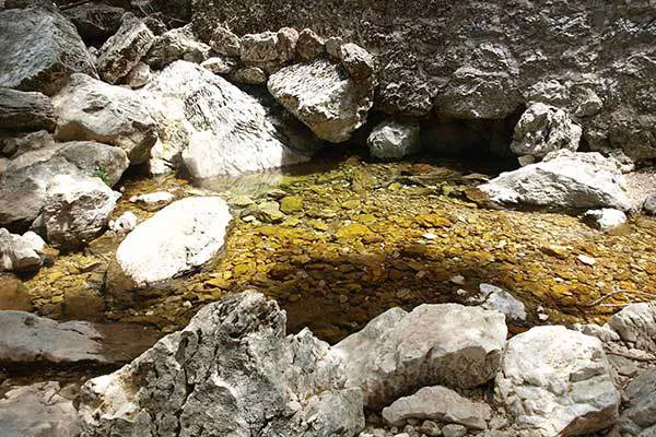
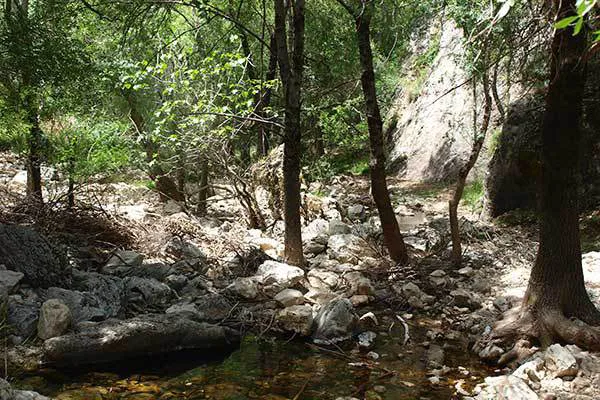
Having reached that point consulting a very large scale map revealed a location about 9 kilometres south south east of the town of Cazorla labelled Nacimiento del Guadalquivir (source of the river Guadalquivir) in a col between two peaks, Cerro Museras and Filo Machero, at a height of 1,400 metres above sea level. We followed a tortuous route via unmade roads and then tracks with precipitous drops from the village of Cazorla into the heart of the Sierra de Cazorla and there we found – The Source of the Rio Guadalquivir.
© Visit-Andalucia 2015 - 2024
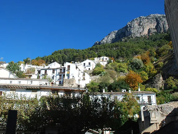 Cazorla
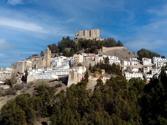 Segura de la Sierra
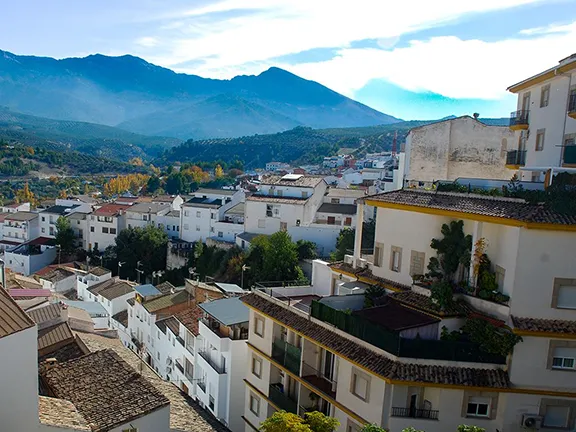 Quesada
 El Chorro Gorge