A walk to the top of La Concha naturally breaks itself into three parts. The views to Gibraltar and the Marbella coast are bteathtaking
By Nick Nutter | Updated 29 Aug 2022 | Málaga | Walking |
Login to add to YOUR Favourites ![]() or Read Later
or Read Later
Summit, La Concha
A walk to the top of La Concha naturally breaks itself into three parts. The first section is about 4 kilometres and a gentle uphill stroll to a saddle from which you have spectacular views over Marbella, Puerto Banus and the Mediterranean. The second section is 1 kilometre further but involves a short scramble on a narrow ledge with a steep drop on one side, not recommended in anything other than good weather. The third section is only another kilometre but involves a scramble and two traverses, one of which, though only three metres long is hazardous in as much as the ledge is narrow, the rock face to which you hold is vertical and the drop is a long way. The effort however is worth it.

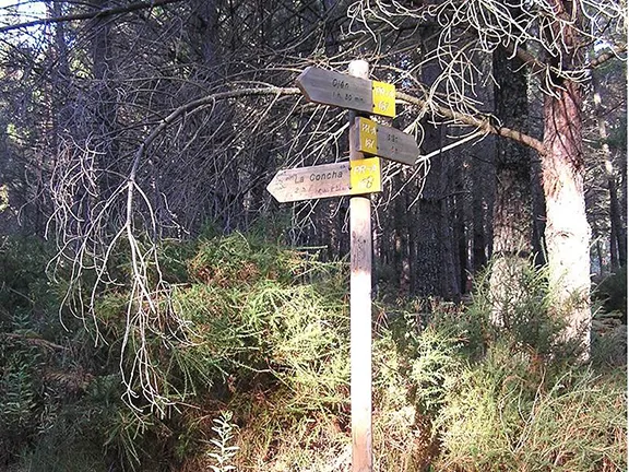
Signpost, La Concha
From the car walk south along a rough road lined with pine and chestnut trees. This takes you gently up to a gate with a style to one side. Continue along the rough road for about 1 kilometre. Olive trees fill the land on both sides. You will see a signpost indicating La Concha to the right, past a white Cortijo.
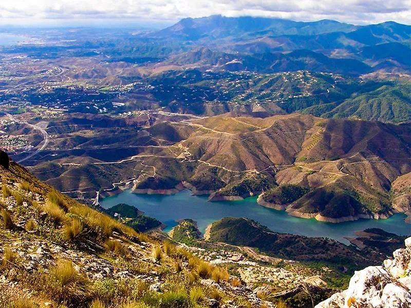
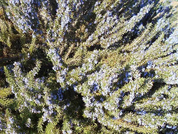
Take this track as it takes you across the top of a shallow valley to another signpost indicating La Concha to the left. You now start to gently ascend through first mixed woodland and then pine trees on a well-marked trail. You emerge on a saddle with mixed woodland and an undergrowth of rosemary and gorse. Ahead of you, far below, is Marbella and Puerto Banus. This is the end of the first section.
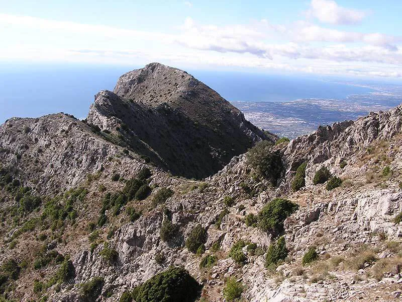
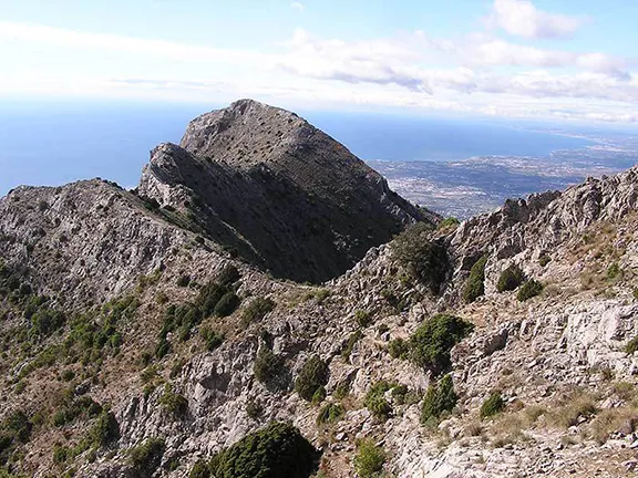
Follow the path along the top of the saddle. You will soon see ahead of you, on the horizon, the rounded summit of La Concha. The path leads you on to a broad ridge and almost immediately crosses the ridge to by pass a rugged hill on your left, Salto del Lobo.
The path then clings to the side of a fairly steep ridge with a short scramble in the middle before ascending back to a much narrower ridge, the hill now behind you. Continue along the path enjoying the views to the left over the coast and right towards Torrecilla on the horizon. La Concha again appears ahead and to the left as you contour around another hill, this time on your right. The path leads you to the neck of a sharp backed ridge that meanders off to the left ending in the rounded dome of La Concha. This is the end of the second section.
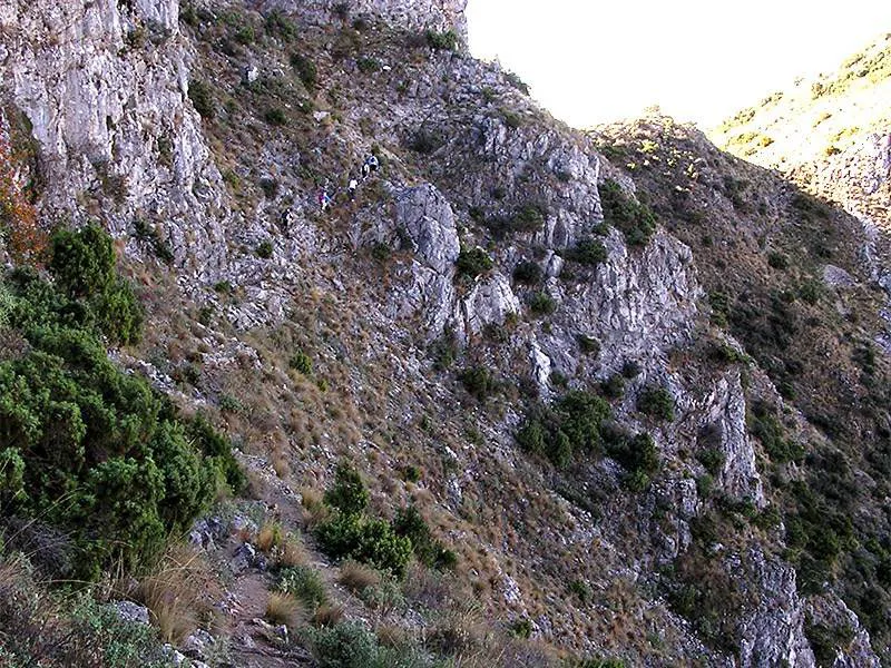
The path becomes less distinct but is marked with cairns and occasional posts and the first part of the next section is obvious. Your target is the ridge just to the right of its lowest point. You may spot a signpost on the ridge depending on the weather.
To gain the ridge however you must follow a narrow path that becomes a ledge. On your right is an almost vertical face and on your left is an almost vertical drop so be careful, especially when you have to swing yourself round a one metre section without the benefit of the ledge. However, once this obstacle is past you rapidly reach the ridge and your efforts are rewarded. The signpost points you in the right direction for Concha, to your left, and indicates the way down another ridge to Istan.
The ridge you traverse is a shorter version of the renowned Striding Edge in the English Lake District except not nearly as eroded by the passage of feet. The path meanders along the razor topped edge. On your right is a steep drop down to the Istan reservoir and on your left a steep drop down to a wide valley that leads to the coast. The path takes you up the ridge to the first of two subsidiary summits and then descends, still razor backed, to a narrow shoulder. Here the path comes off the ridge to the right in order to by pass the second summit. The ridge top is on your left and above you. Take note of where you left the ridge because you have to return the same way. The way on is obvious but involves a little bit of scrambling made more exciting by the exceedingly steep hill down which you would roll if you fell before you arrive again on the ridge with the second summit safely behind you

First Traverse, La Concha
The final obstacle, the rounded summit of La Concha itself is now ahead and the path disappears. The occasional cairns mark possible routes of which there are two, along the top or slightly off the ridge to the left. Mountain goats can just hop along the top of the ridge. Lesser nimble footed walkers can divert from the top of the ridge, slightly left but always ascending, sometimes resorting to scrambling until both routes merge and you have the satisfaction of walking onto a proper domed summit. There are two further minor summits along similar ridges, the furthest about 200 metres away, for those with any breath left, after which the ridge abruptly ends.

Looking down on Istan, La Concha
The views are breathtaking. On a clear day you will see Gibraltar to the south and the entire coast from there to Marbella to the east. You can see down the coast to Málaga and beyond to the high Sierra Nevadas near Granada. Looking the other way, Los Reales above Estepona is an easy landmark with, to its right the Sierra Bermejas merging with the Sierra de las Nieves with the peak of Torricilla appearing very pale to the west. Directly below to the east you can look down on Puerto Banus and Marbella.

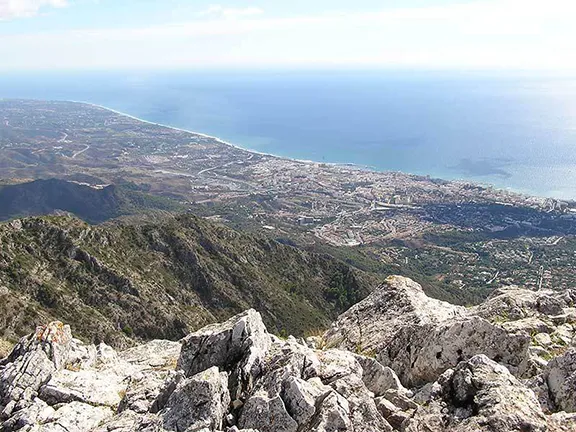
Looking down on Marbella, La Concha
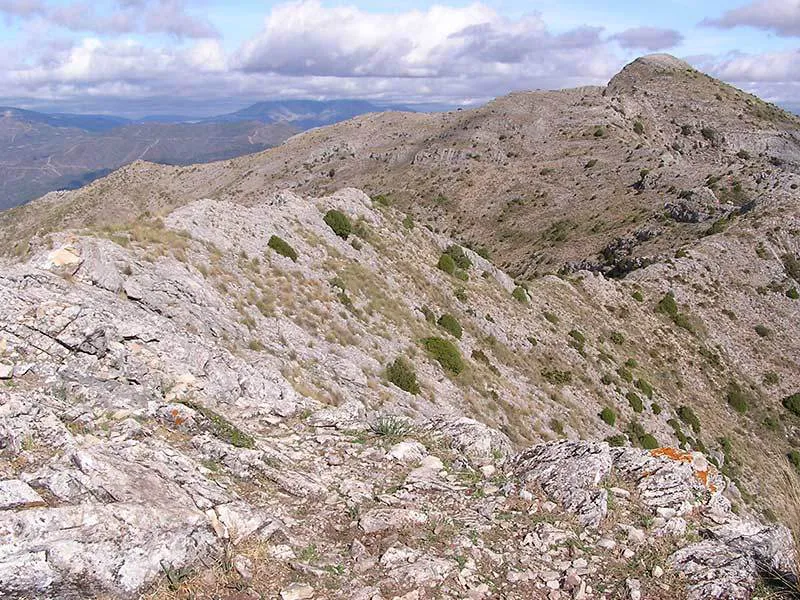

Razor Ridge, La Concha
Start and Finish: Car parking area in the vicinity of the Refugio de Juanar. Distance: 14 kilometres.
Difficulty: Medium to Hard.
Essentials: Boots, waterproofs, food, water, map (obtainable from the Refugio)
© Visit-Andalucia 2015 - 2024
 Rosemary Walk
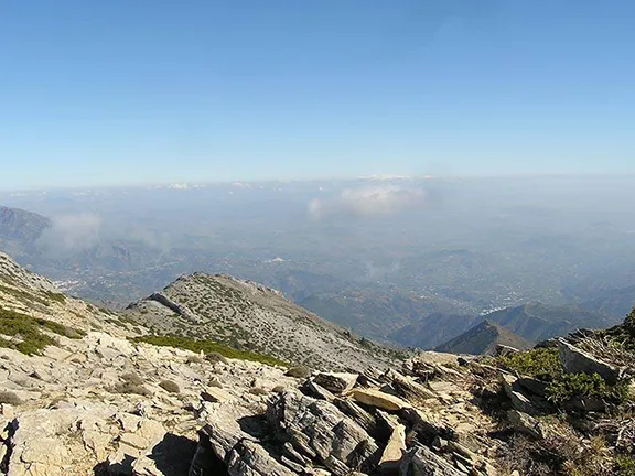 Torrecilla Walk
 Vulture Restaurant