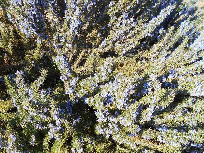
This is one of our favourite walks. When the rosemary is in flower all you can hear is the buzzing of bees and the hillsides are carpeted in powder blue
By Nick Nutter | Updated 29 Aug 2022 | Málaga | Walking |
Login to add to YOUR Favourites ![]() or Read Later
or Read Later

Rosemary Walk
This is one of our favourite walks. When the rosemary is in flower all you can hear is the buzzing of bees and the hillsides are carpeted in powder blue interspersed with the yellow gorse.
The walk starts at the Refugio de Juanar that you reach by driving up the Coin road from Marbella, the La Canada turnoff if you are on the A7. Drive past Ojen and keep your eyes open after 1 kilometre for a sign on the left indicating the turn off to the refugio. Follow the narrow road about 7 kilometres, the refugio is on the right over a stone bridge. Parking is available a few metres further up the road.
Rosemary Walk
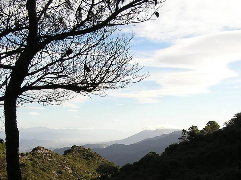
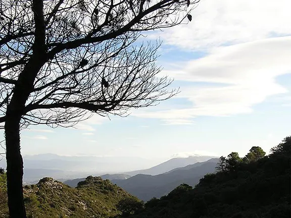
From your car walk back down the road you drove up for 700 metres. On your left you will see a gap in the wall and rough steps leading down to the stream bed. Follow this path as it crosses the stream bed and then climbs the ridge on the far side. Short steep sections are interspersed with gentle traverses so that you reach the ridge line about 1 kilometre further down the valley. The views north east towards the Sierra Nevadas are spectacular on a clear day. Look out for orchids and bulbs on this section.
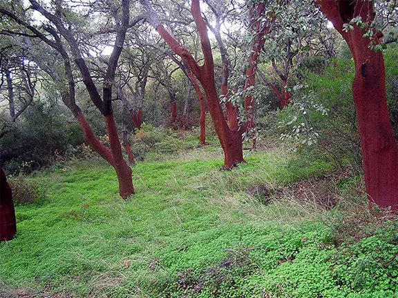
At the top of the ridge the path doubles back on itself around the ridge, ahead and up, the shoulder over which you will travel opens to view. The path follows the course of a normally dry stream bed through gorse, broom, cistus and rosemary. Take a moment to stop on this section and just listen. You will hear the sound of thousands of bees on the herbs.

Rosemary Walk
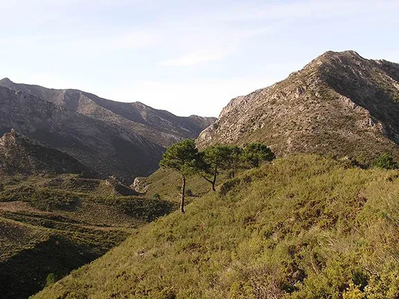
At the top of the shoulder, the highest point of the walk at 1012 metres, you will see two paths, one ahead and one climbing the ridge to the right. Take this one for about 50 metres to a grassy clearing ideal for a picnic stop. The views in both directions are superb.
Return to the ‘junction’ and turn right. The path follows the contour lines around the spurs of a ridge in a large loop and as it does so different vistas are seen between the mountain peaks ahead and on the left and right. The obviously pale mountain seen on the horizon here is Torricilla, the highest in the Sierra Bermeja. This is followed by a view of the top end of the Istan valley followed by views towards Los Reales above Estepona and La Concha above Puerto Banus.
After about 3 kilometres the path enters a section of water worn mudstone and sand that looks very like a beach. In fact it was a beach hundreds of thousands of years ago. Notice the rock strata is almost vertical. The whole lot has been pushed 1000 metres up from sea level to its present elevation by the force of the African continental plate pushing against the European continental plate. This process is continuing and these rocks are still rising.
The raised beach section takes the path across another small shoulder to the side of a ridge where you will find yourself winding through thorny bushes. Long trousers are useful here. I scratched my leg on one such section and when I got home I found a small tick like insect attached to the wound by its mandibles happily drinking my blood.
You will soon reach a path junction marked with a post with yellow and white bands. To the right is a similar post with a yellow and white cross on it. Do not go this way. Walk straight on and a very obvious track starts to descend towards an area of woods surrounding the refugio far down in the valley. The track hairpins down as you lose all that height gained earlier. You enter the woods and emerge opposite the car park.
Start and Finish: Refugio de Juanar
Distance: 9Km
Time: Allow 3 hours
Essential Equipment: Walking shoes or boots, water or flask. For this walk I would also advise a simple first aid kit, sun block cream, waterproof and windproof jacket. The walk is at a high elevation and can be subject to rapid changes in weather. The high point is 3,300 feet, Scafell Pike the highest mountain in England is 3,210 feet.
© Visit-Andalucia 2015 - 2024
 Vulture Restaurant
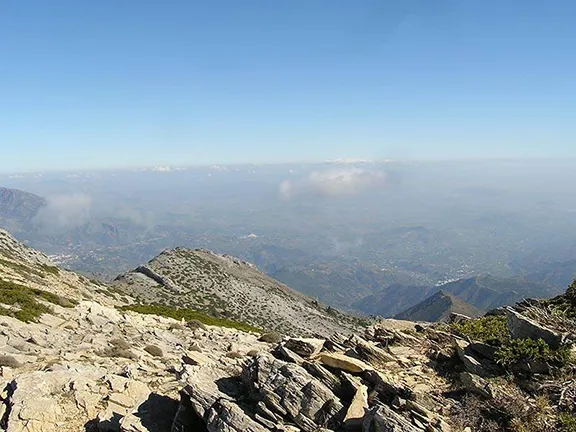 Torrecilla Walk
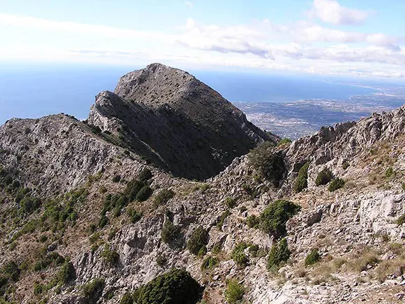 Ascent of La Concha