Walk to the Petroglyphs: 2500 BC rock art in the valley of the river Gor near Gorafe in Granada province in the Granada Geopark
By Nick Nutter | Updated 18 Mar 2023 | Granada | Walking |
Login to add to YOUR Favourites ![]() or Read Later
or Read Later
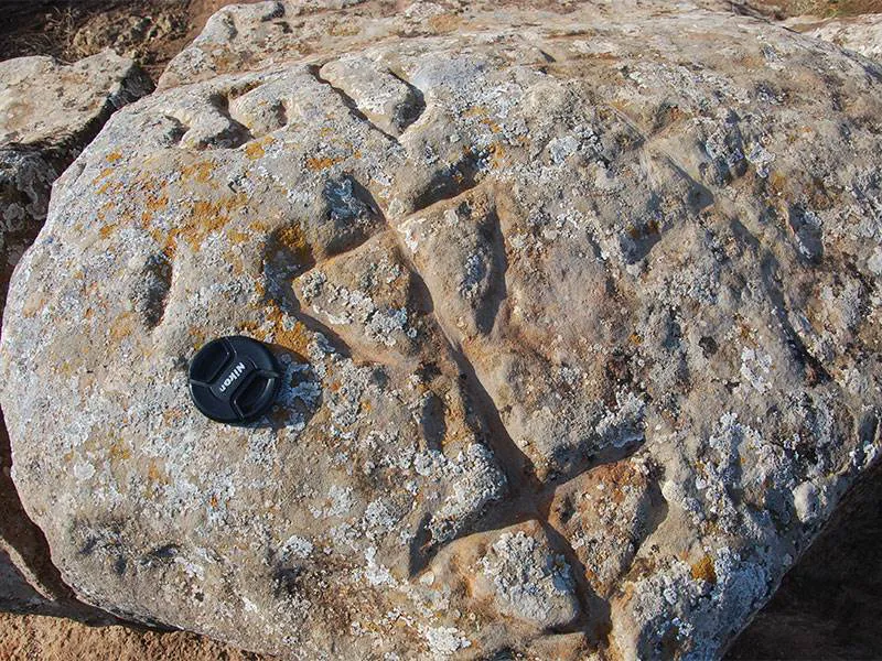

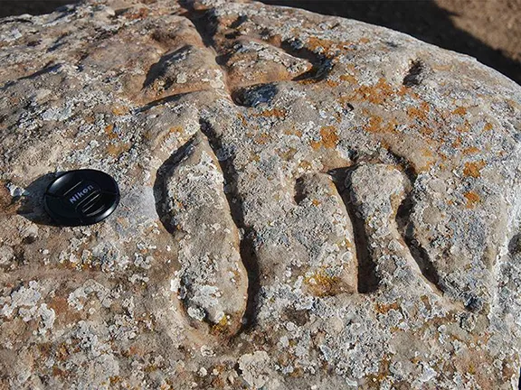
Female figure
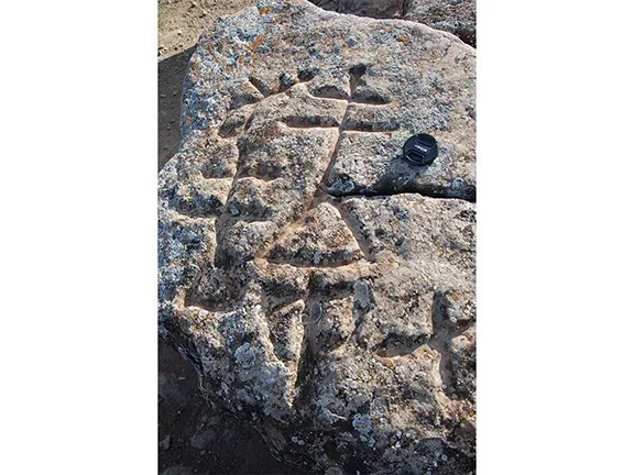
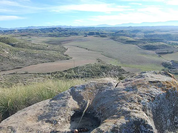
The Megalithic landscape of the Gor river valley in Granada province would not have been complete without some arte rupestre; cave or rock art. Close to the dolmen complex of Baños de Alicun, near Alicun de Torres, the early Iberians, about 2,500 BC, found a source of ‘almagra’, a soft, deep red ochre, that, mixed with grease, makes a paint that was used in arte rupestre, for decorating the body and in burial ceremonies. Near to the source of almagra, they also found five sandstone blocks suitable for engraving. The site is high on a ridge, that looks south and west over the Gorafe valley and the greatest concentration of dolmens in Europe. It was here that these Neolithic people decided to create engravings or petroglyphs and conduct their ceremonies. The petroglyphs depict male and female figures dancing, the sun and moon and other symbols that could represent bows and axes. The sun symbol is deeply incised in a bowl and still used today for ritual offerings. The petroglyphs of the Cerro de la Minas, as they are known, are difficult to locate, not signposted, not waymarked and unmarked on arrival.
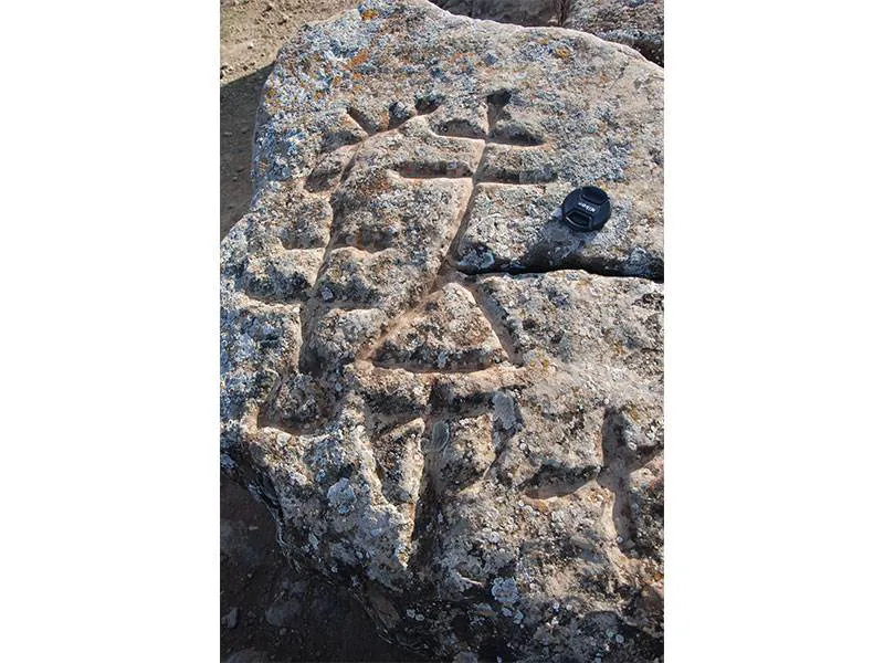
Couple dancing
Start the walk at the well signposted Baños de Alicun. Leave the baths and walk along the road to the junction with the GR 6101 and turn right. After a couple of hundred metres you will see an abandoned cortijo on your left. If you approach from the Gor end of the valley, along the GR 6101, the ruined cortijo is on your right. There is also a small amount of space for parking.

Modern ritual offering
On the left of the cortijo is a gravel track barred to vehicles with a chain. Follow this track, up, until it meets another gravelled track where you turn left. Ahead of you, on your left you will soon see a mirador overlooking the Baños de Alicun and the magnificent travertine aqueduct on the other side of the valley.

Bow, Axe ?
Ahead you will see a concrete blockhouse with an aerial on its flat roof. Follow the gravel track to this building. Bear right at this point following a less well trodden track up the hill. You will soon join yet another gravel track. To your left this track stops after a few metres at an abrupt precipice, the views are good, but we want to go right following the gentle incline as it circles a hill. At a three-way track junction keep left.


Video By: Julie Evans

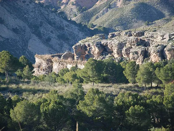
View of travertine
The track levels out somewhat as it reaches the top of the hill and you will find yourself heading in a south westerly direction. Ahead of you is a slightly higher hill with a rough path. Look for a small cairn on the left hand side, here there is a poorly defined path. Take this path through the tussock grass looking ahead for the large boulders.
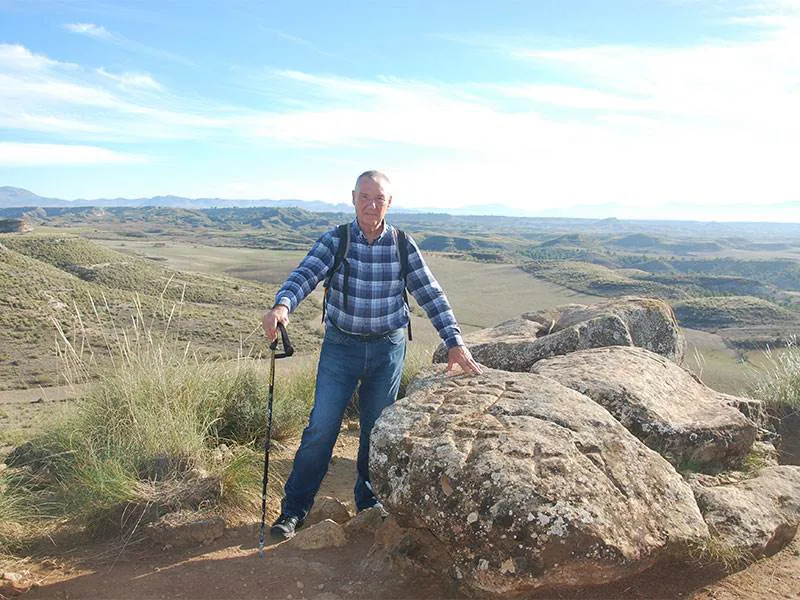

4500 year old landscape (It feels that way sometimes)
The petroglyphs are the oldest to have been found in the province of Granada and viewing them is well worth the walk.
Although the petroglyphs are the main objective of the walk, the views across the megalithic landscape of the river Gor are magnificent. We also saw five ibex.
During the Neolithic period, every task had to be worthwhile, to have meaning for the individuals, families and tribes that spent time on those tasks and carving petroglyphs in stone was no exception.
The Neolithic people did not have a written language as such. To communicate with each other directly they had a language, usually called Paleo-European, although what that language sounded like and what words were included in the lexicon is not known although we can surmise that they had words for common things such as rivers, sun, moon, stars, forests, mother, father etc. In the case of visual communication, rock art, cave paintings and petroglyphs, they used symbols that must have been universally understood. Those symbols carried meanings and could have been meant to represent tribal or family affiliations, the use to which a site within the landscape was used or as boundary markers to delienate territory.
The petroglyphs of Cerro de la Minas are in a stylistic form, human figures for example are depicted as 'stick figures', much as a child of today may draw a human body. Sun and moon engravings are easily recognisable. But what do they mean?
My own interpretation looks first of all at the site of the petroglyphs, on a ridge at the junction of two well populated valleys. It is not too controversial to suggest that the petroglyphs signposted a meeting place.
The individual petroglyphs may show the use to which the site was put. For instance, the two figures apparently dancing could indicate this was a site used for feasting, dance and music. The single female form could indicate the site was also used for meetings between the families living in the valleys to enable the male members to choose female partners or even, vice versa. Matriarchal societies were by no means unknown during this period. The engravings of the sun and moon could indicate when those meetings took place. Finally, the engravings of the axe and bow. My own view is that they indicate to any person arriving at the site that weapons were not allowed, if you attended a ceremony at this place, you left your weapons outside the ceremonial space.
The whole walk there and back is about 4 kilometres. It should take 1.5 hours, allowing time to admire the views and petroglyphs.
The track is rough in places so boots are recommended.
A geoparque (geopark or geoparc) is a well-defined territory, home to a valuable natural geological heritage. The most important parts of a geoparque, due to their scientific, aesthetic, or educational value, are called geosites.
In the north of Granada, surrounded by some of the tallest mountains of the Iberian peninsula, what we know today as the Basin of Guadix or the Guadix - Baza depression or basin was, for 5 million years, a lake with no outlet to the sea. Sediments, brought down by the mountain streams, were deposited in the basin in horizontal sheets. 500,000 years ago the basin drained to the west and new streams carved out the canyons, ravines and badlands that characterise the area, the most southerly desert in Europe, today.
The petroglyphs are a geosite within the river Gor dolmen area.
The map marker shows the location of the petroglyphs rather than the start of the walk. The co-ordinates, if you want to plug them into your smartphone are: latitude: 37.5056901 longitude: -3.1003912
© Visit-Andalucia 2015 - 2024
 Las Angosturas walk
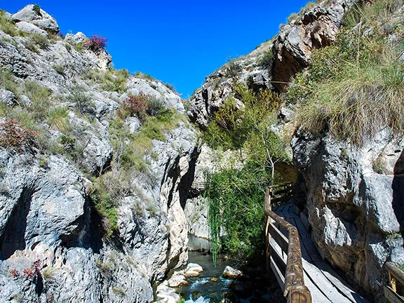 The Rio Castril Walk
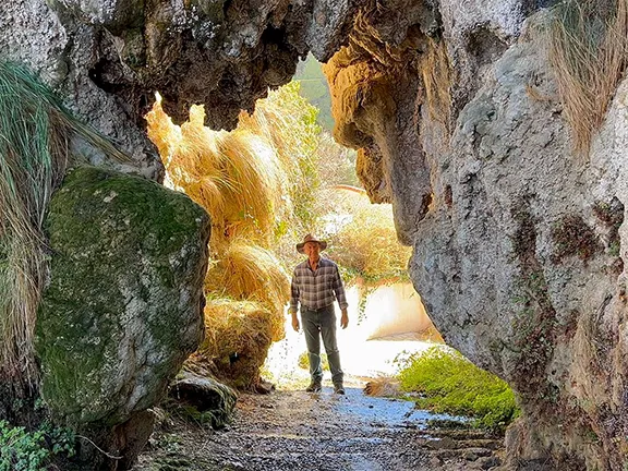 Travertine Aqueduct Walk