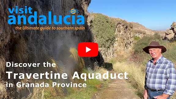
The Travertine aqueduct or canal is a natural structure made of soft limestone, travertine. It is unique in Europe and the Granada Geoparque
By Nick Nutter | Updated 18 Mar 2023 | Granada | Walking |
Login to add to YOUR Favourites ![]() or Read Later
or Read Later

Through the travertine aqueduct
Although this walk is only 2 kilometres in length, there is so much to see it could easily take a half-day to get round. The remarkable features that define this walk are the travertine aqueducts. Baffled? Read on.

Shaggy Dog Gorge
The walk starts at the car park in front of the Hotel Reina Isabel. To your right, facing away from the hotel is a gateway, sometimes with a chain that you can ignore. Just past the chain is a Junta de Andalucia board that gives some information about the travertine.
About 216,000 years ago, a hot spring emerged from the side of a hill at a temperature of 35 degrees centigrade. The spring was heavily mineralised with calcium bicarbonate and other minerals dissolved in it. As the water spread out over the landscape, the minerals precipitated out and solidified. They became layers of travertine, a soft rock.

Between two aqueducts
About 3,500 years ago, people from the Neolithic settlement of Alicún de las Torres decided that they would like to have warm running water in their settlement. Fortunately for them, they lived within 1 kilometre of one of the eight mineralised hot springs in the area. They dug a narrow channel from the spring to their settlement.
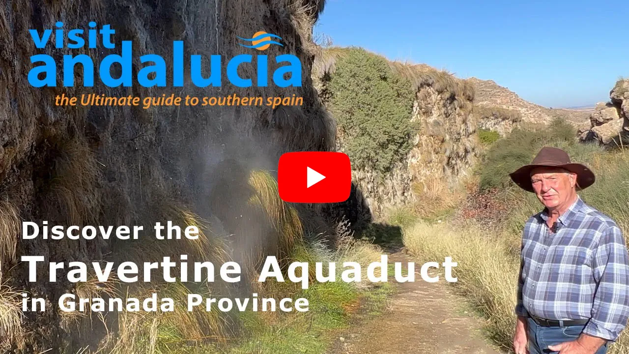
Video By: Julie Evans

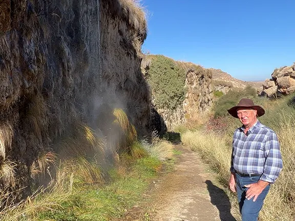
Over time the calcium bicarbonate and other minerals precipitated out at the bottom and sides of the channel. It created a ridge, that grew to a wall, with the water channel on the top and finally achieved the height it is today, 15 metres. The thickness of the aqueduct varies between 1 and 4 metres and is still growing. The structure is unique in Europe. The walls of the aqueduct host plants, including one unique to the aqueduct, Limonium Alicunense (Plumbaginaceae), that enjoy a mineral-rich environment and, in places, a dash of warm water spray from the occasional leak in the channel.
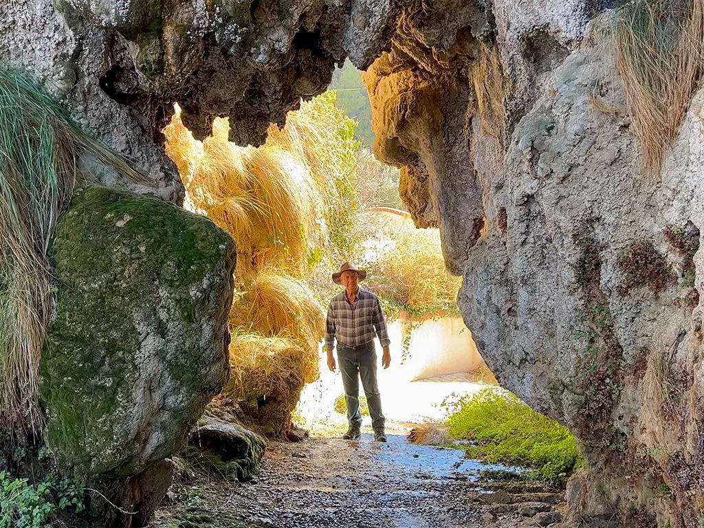
The aqueduct, known as the Toril Aqueduct or Canal, starts at knee height just behind the notice board. Follow the well walked path that follows the aqueduct. The trail descends, but the aqueduct remains at the same level.
Within a few minutes walking, you will find the aqueduct on your left and a cliff on your right. You should also see two cave houses, now long abandoned, in the cliff. Notice that one has two stories, the first floor being created from rafters across the chamber with a wooden deck on top of the beams. The aqueduct has already started to tower overhead, and the near-vertical sides are populated with tufty grass. It resembles the coat of a gigantic shaggy dog.
A few metres further and you will see that curious walkers have worn rough steps into the side of the aqueduct. A careful scramble to the top allows you to peer into the water channel, yes it is still very warm, and you will realise that while the aqueduct is 4 metres thick at the base, it is only an arm’s length in width at the top.
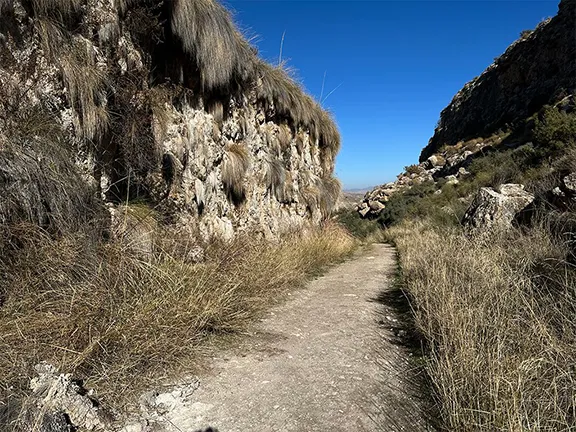
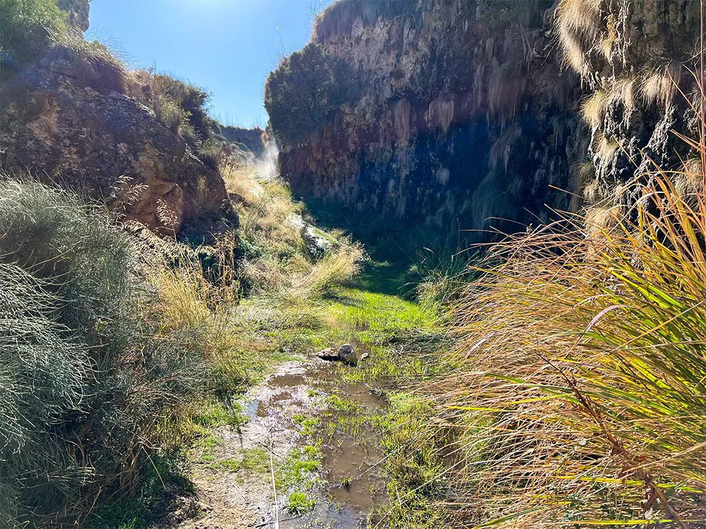
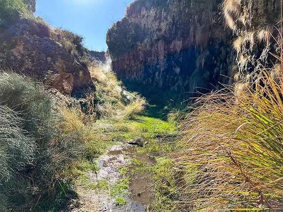
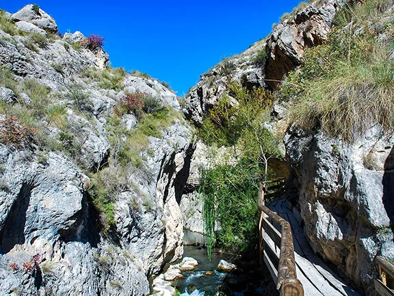
Walk on. You will now be in a canyon with the aqueduct to your left. In places, the aqueduct has been cut through to create tunnels, part man, part nature. In any case, these tunnels do allow you to look at the internal structure of the aqueduct. They lead to a viewing platform overlooking a spa.
Eventually, the path ascends and is again at more or less the same height as the aqueduct. Cross the aqueduct here and, for a truly unique experience, walk back the way you have just come. You will find yourself between two high travertine aqueducts and, at one point, walking through a warm shower. Return to where you crossed the first aqueduct. There is more to see.
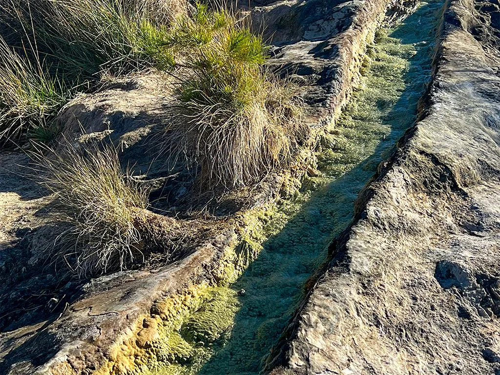
The path takes you over the first and second water channels. The second channel diverts off, down the hill. A primitive sluice gate controls the flow of water from the main channel. You can see, in the water channel, the crystals of various minerals precipitating out of the warm water, green yellow and white. It must have fascinated Neolithic people.

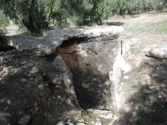
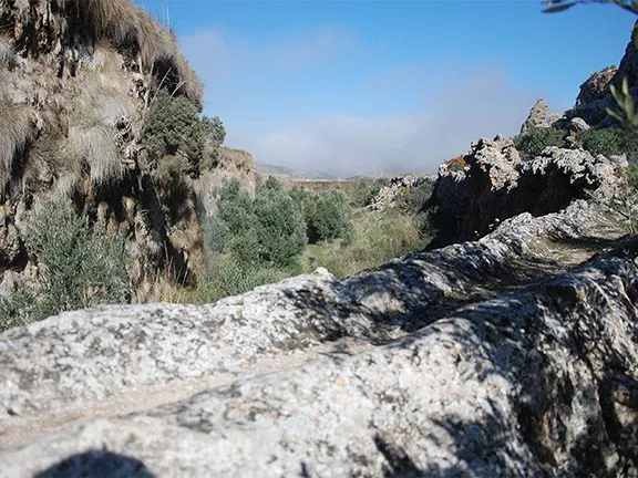
The path now starts to take you back towards the hotel. To your right is a wide valley. This is where the Neolithic settlement, Alicún de las Torres, was situated. Their necropolis, made up of several dolmens, was outside and overlooking the settlement, at the same height up the valley side as the path. These dolmens are the first ten in the series of 242 to be catalogued between 1955 and 1959. None that we saw had any plates with numbers. Six of the dolmens are readily visible from the path.
The pleasant walk continues back towards the hotel, via one of the tunnels through the travertine aqueduct to the gorge, you came down earlier.
A geoparque (geopark or geoparc) is a well-defined territory, home to a valuable natural geological heritage. The most important parts of a geoparque, due to their scientific, aesthetic, or educational value, are called geosites.
In the north of Granada, surrounded by some of the tallest mountains of the Iberian peninsula, what we know today as the Basin of Guadix or the Guadix - Baza depression or basin was, for 5 million years, a lake with no outlet to the sea. Sediments, brought down by the mountain streams, were deposited in the basin in horizontal sheets. 500,000 years ago the basin drained to the west and new streams carved out the canyons, ravines and badlands that characterise the area, the most southerly desert in Europe, today.
The Toril aqueduct is a geosite due to its unique geology.
© Visit-Andalucia 2015 - 2024
 The Rio Castril Walk
 Walk to the Petroglyphs
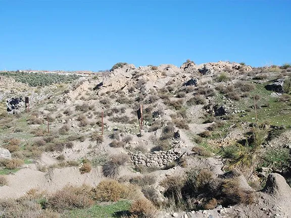 Las Angosturas walk