A full day that takes you to a 'de la frontera' white village, through the white villages of the Genal valley via a mountain road and then to Ronda before returning you to the Costa del Sol.
By Nick Nutter | Updated 14 Sep 2022 | Málaga | Places To Go |
Login to add to YOUR Favourites ![]() or Read Later
or Read Later
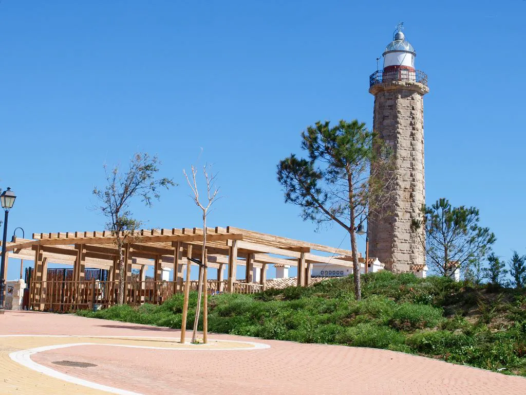
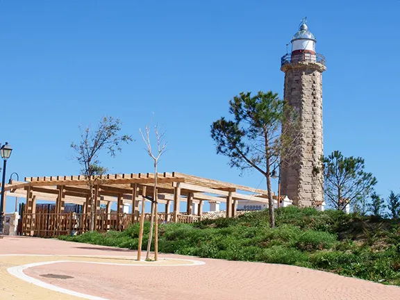
Estepona Lightouse
This round trip takes up a full day and can be started and finished from any of the coastal resorts between San Pedro de Alcantara and Sotogrande: San Pedro de Alcantara , Benavista, Estepona, Sabinillas, Puerto de la Duquesa, Castillo de la Duquesa, Torreguadiaro or Sotogrande.
Drive south down the A7 to Torreguadiaro where you join the A2102 signposted San Enrique and San Martin de Tesorillo. You will pass beneath the road bridge carrying the AP7.
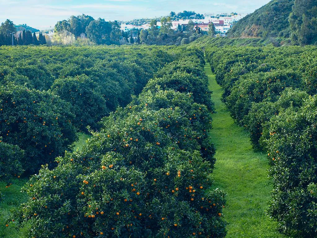

Orange groves at Guadiaro
The village to your left, across the citrus plantations in the valley of the Rio Guadiaro is the village of Guadiaro.
Guadiaro is also the first point on the river at which it was convenient to cross. Until 1929, when a Spanish engineer called Torrojo built the magnificent Iron Bridge, the crossing was by riverboat. You will see this bridge on your left when you arrive at a small roundabout on the A2102 where you bear right to continue towards San Martin.
Without the Rio Guadiaro, that never dries out in these lower reaches, even in the driest summer, the valley would be a parched wasteland. The abundant water, combined with the temperate climate, makes the valley ideal for the growing of fruit. Travelling up the river valley you soon enter the town of Secadero. So abundant was the river that when Secadero was founded in the 19th century, the main crop was rice. Today however the paddy fields have been given over to oranges and there is a thriving juice industry in the town. Between February and May the roadsides are lined with stalls selling surplus oranges by the ten-kilo bag for a fraction of the supermarket price. At the same time the scent of the new blossom on the trees is overpowering. Oranges take just over a full year to germinate, swell and ripen.
At Secadero we once again cross the Rio Guadiaro and enter the town of San Martin del Tesorillo. Oranges are the mainstay of the town with lemons, avocados and pomegranates. In the winter of 2005, a particularly cold night produced a frost that, overnight, killed the entire citrus crop and burnt all the leaves. Fortunately, the frost was not that severe that it killed the trees themselves but they did take two years to recover. San Martin is a centre for the study of medicinal plants indigenous to the area. As we travel towards Jimena de la Frontera we are alongside the strangely named Rio Hozgarganta that joins the Guadiaro just below Secadero.
As we move up the valley of the Hozgarganta we see a change in the vegetation. The orange groves become smaller and finally end, the land becomes more open with stands of eucalyptus and there are more cattle. This valley, due to it facing the southwest and the Atlantic, is just that bit colder than the valley of the Guadiaro that faces south and the Mediterranean. On the far side of the river is the railway line that runs from Algeciras to Bobadilla beyond Ronda.
In the late 19th Century British officers, garrisoned at Gibraltar, enjoyed the campo and travelled as far as Gaucin but the roads were narrow with potholes and craters and the carriages often had to navigate around boulders fallen on the road from the hillsides above. It took many hours, sometimes days, to even reach Gaucin. In 1890 a British engineer, John Morrison, with the backing of his friend, Sir Alexander Henderson, later Lord Faringdon, proposed a single-track rail line between Algeciras and Bobadilla where it would meet the main line to Madrid. The pair had previously been responsible for building railways through atrocious country in South America so had little difficulty in Spain.
The first section of line, to Estación Jimena, was opened in October 1890 and the second stretch, to Ronda, in November 1892.
It is worth parking up in Estación Jimena near the level crossing and taking a look at the colonial style station.
.webp)
-sm.webp)
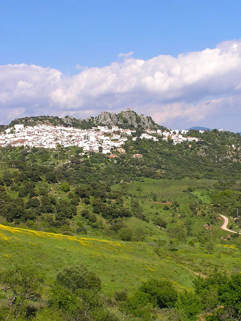
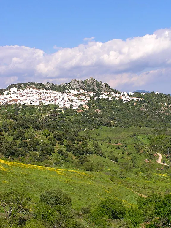
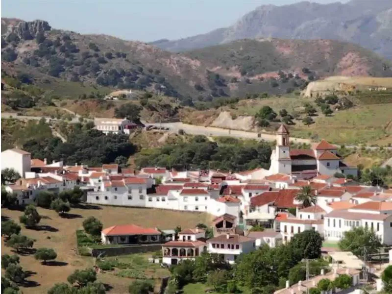
Jimena de la Frontera
Passing through Estación Jimena we reach the left turn to Jimena de la Frontera. Numerous civilisations have gone through the lands of Jimena: Iberians, Roman, Visigoth, Arab and Christian.
The white village of Jimena de la Frontera surrounds its castle. Typical narrow, winding, streets wend up the hill from the square, dominated by a clock tower. Parking is at a premium in the village so if there is a space and you intend to explore Jimena, the car park is just before the square.
The bars, cafes and restaurants in the vicinity of the square all serve tapas as well as full meals. The food is traditional Andalucian including one dish peculiar to this area, Tagarnina, made from edible thistles.
Continue driving through the village via the main street that leads from the square.

Los Alcornocales Natural Park
Jimena is situated in the Alcornocales National Park, an area of 170,000 hectares and one of Europe's largest Mediterranean forests. The main species of tree is the cork oak, the bark of which is still cut revealing first the shiny crimson trunk that fades through ginger as the bark re-grows. Once the bark is cut the tree takes ten years to recover. Hidden away in the deep valleys and watercourses are some surprises. The terrain has produced a microclimate that, from the Tertiary period, has enabled some prehistoric plants to survive, there are varieties of alder, ash, laurel, hazel and rhododendron as well as several species of fern still growing and looking as they did 1.5 million years ago. One extraordinary species, Psilotum nudum, the fork or whisk fern was only discovered in 1965 by Betty Eleanor Gosset Molesworth Allen, a renowned English botanist. It is 300 million years old.
Once through Jimena, we reach the road to Ubrique. Turn right and you soon reach the village of San Pablo de Buceite. At this point we rejoin the Rio Guadiaro and find, once again, orange orchards. There is also the Venta el Chute, a traditional Spanish venta, which provides a welcome refreshment break.
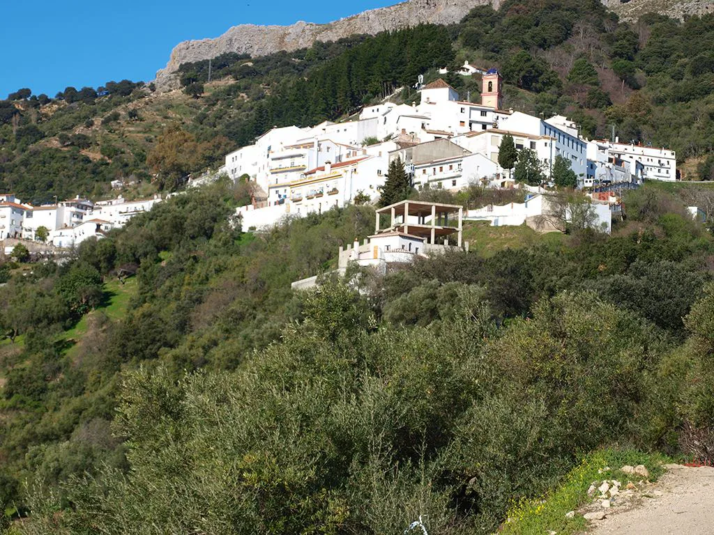
From San Pablo the road starts to climb. It is one the official 'Carratera Montana' of Spain and, until only a few years ago, was a single-track road only really suitable for donkeys and pedestrians. In 15 kilometres you will reach the right hand turn into the white village of Gaucin. In the meantime, as you drive higher, you are treated to fantastic mountain views that most visitors to the Costa del Sol will never see. You are best parking on the outskirts of the village if you intend to explore. You can then re-join the mountain road at this junction.
Gaucin
Populated since the Neolithic period, Gaucin is now a favourite destination for artists both for the clear air and the panoramic views, not to mention the jumble of white houses that offer unlimited opportunities for artistic expression.
The Castle of the Eagles looks down on the village and is well worth exploring just for the views into the Genal valley and south as far as Gibraltar.
Rejoin the mountain road that bypasses the village of Gaucin, just past which there is a mirador from which you can see the whole area. To the east are the Sierra Bermeja mountains with Los Reales the most prominent peak, and to the south Casares and the peak of Sierra Crestellina. To the southwest is the broadening river valley that widens out to the plains surrounding Gibraltar.

Genalguacil across the Genal valley
Continuing along the road towards Ronda we can see, to the east across the Genal valley, the white villages of Genalguacil, Jubrique and Farajan. A mirador just past the turning to Cortes de la Frontera is the best place to stop to admire the view.

Algatocin in the Genal valley
On our side of the valley we pass through the picturesque village of Algatocin even higher than Gaucin at 724 metres. It is believed that the town was founded in the 14th century by a Berber tribe called the Al Atusiyin, from where the name derives. Little is known about its history since then, except that, following the re-conquest in the 15th century, Algatocin grew steadily into the prosperous town it is today, with agriculture the main source of income for most of the inhabitants. Overlooking the town is La Fuenticilla, a small hotel with an impressive traditional Spanish menu that includes wild boar, a selection of tasty tapas and excellent coffee.
Suitably refreshed the next town along the road is Benadalid. The houses in Benadalid are mainly small and whitewashed, with two tiny windows, one close to the door on the ground floor and one on the second floor. The doors are usually framed in wood, mainly chestnut, and there is often a shutter or half-door to allow the light and air in without having to keep the door open. There are many Baroque doorways in the town, in most cases being of simple design, but some having intricate carvings in Renaissance style. These date from the 17th and 18th centuries, although there are some later examples too. This type of decoration is also used in the windows of some houses, which is a typical Baroque element. The northern part of the town is the oldest with most Moorish influence and the southern part dates from after the reconquest in the late 15th century. After the reconquset, unusually, the Muslim population were allowed to stay in Benadalid, living alongside their Christian neighbours, until the expulsion of the Moriscos almost one hundred years later. To the north of the town is a castle, now used as a cemetery. Some historians suggest it is Roman, others that it dates from the 13th century. It is likely a combination of the two.
Atajate in the Genal valley
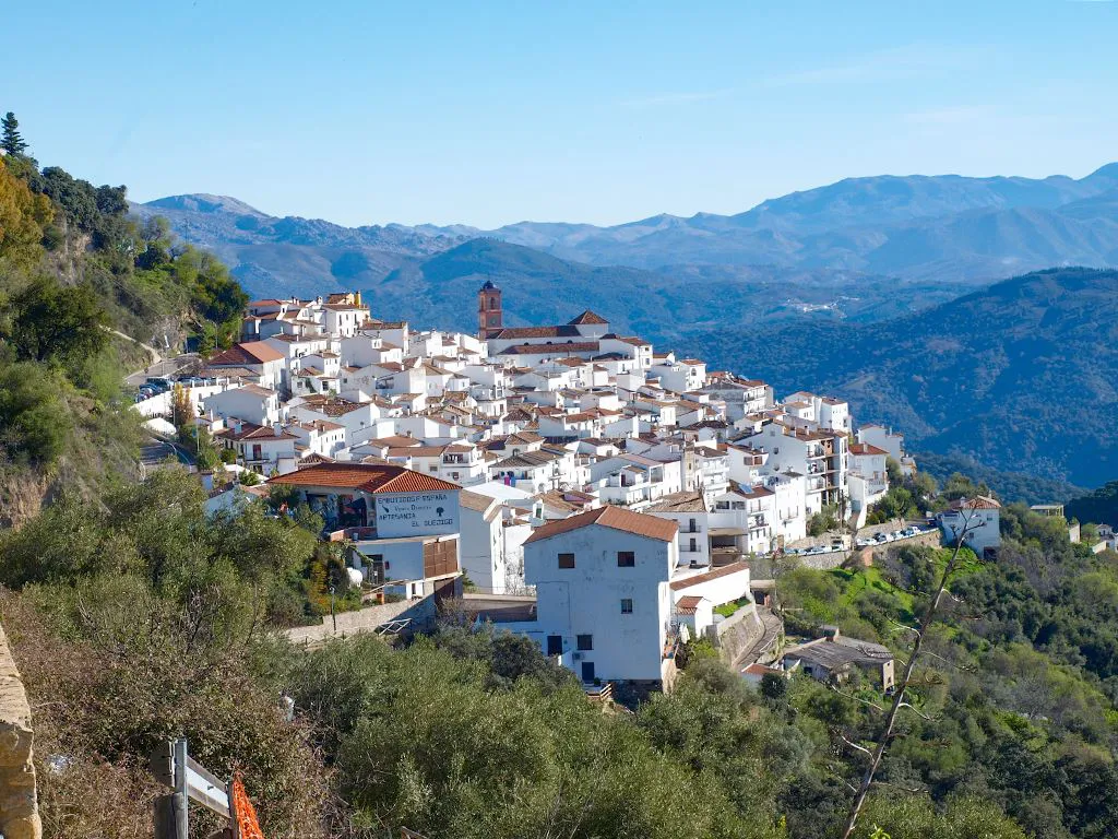
The next town, Atajate, is even higher than Algatocin, at 745 metres. It is perhaps the prettiest of the white villages, set back off the main road that now, thoughtfully, by passes this tranquil place. Atajate has not always been so tranquil since, during Muslim times, it occupied a strategic position between the kingdoms of Seville and Granada. Then, during the long war to evict the Muslims, Atajate was in a strategic position again, this time between the Muslims and the Christians. Even after the reconquest Atajate suffered, this time in the early 19th century at the hands of Napoleonic troops. The local population fled to more peaceful surroundings leaving the town in the hands of bandits who held up coaches on their way from Gaucin to Ronda.
Leaving Atajate the road climbs into the mountains, the last barrier before Ronda. Most of the rock here is limestone that has formed the characteristic forms known as karstic. Deep fissures produced by water erosion of the soft, soluble rock, producing a rugged, forbidding, landscape. The eagles and vultures that spiral in the thermals above the sun-heated rock are at home here. You are most likely to see griffon vultures and booted eagles. You may be lucky and spot kestrels and hawks.

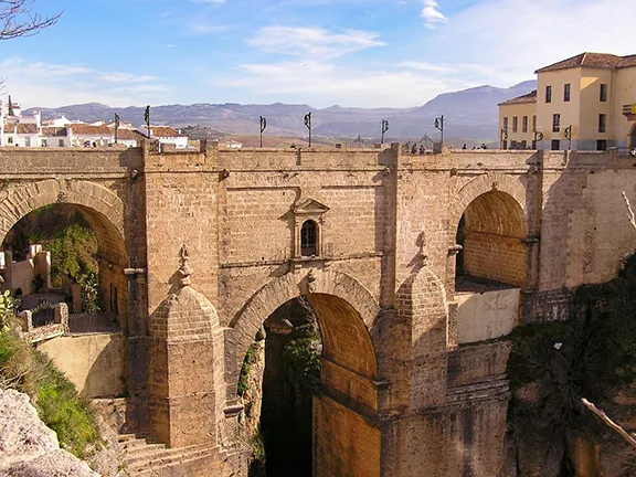
Tajo Bridge Ronda
Finally, we descend towards Ronda, a typical Andalucian city in more ways than one. We approach the town from the west and our first view of the walls is the south gate into the city, clearly Muslim.
The best to see Ronda is on foot so we continue into town and use one of the car parks.
The easiest way to leave Ronda is to head north following the signs to the circumnavigation and then the signs for San Pedro de Alcantara. Looking to your right you will have a good but brief view of the lower city walls. Although we are now heading back towards the overpopulated and overbuilt Costa del Sol, the day is far from over. As you leave the environs of Ronda, to your left is the highest mountain in the Sierra Bermeja, 'Torrecilla' at 1,919 metres and to your right, lower but no less imposing ranges opening out until you see Los Reales in the middle distance, last seen from Gaucin. The white villages in the Genal valley can be seen way back to your right.
Suddenly you drive around a spur and there is the blue Mediterranean. It is, as yet, so far away that the efforts to bury the shore in concrete are not that obvious, the views east and west are breath-taking. Just before you reach San Pedro you will reach the toll road. If you have no desire to experience the concrete jungle you will find that, for a few euros, it takes a much more rural and less frenetic route back to Estepona that still offers tantalising glimpses of the coast to your left down steep, parched valleys.
© Visit-Andalucia 2015 - 2024
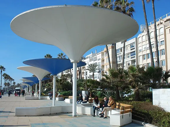 Estepona
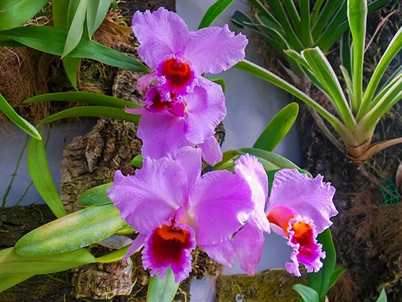 Orchid House or Orquidarium
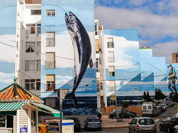 Murals, Mermaids and Museums
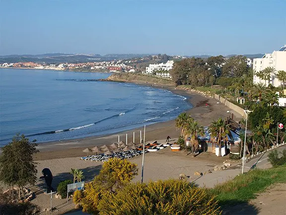 Playa del Cristo Beach
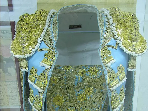 Bullfighting Museum
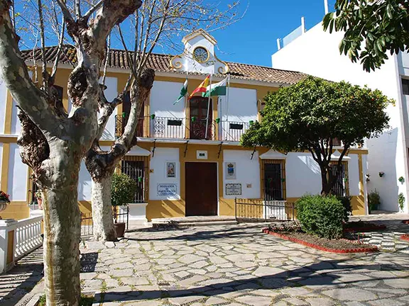 Archaeological Museum
 Paleontological Museum
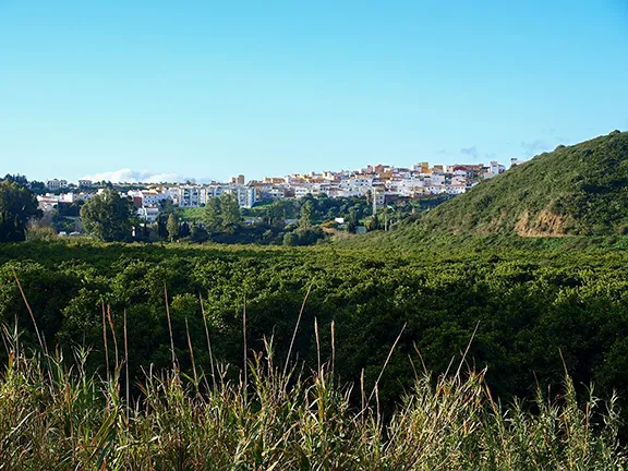 Guadiaro